SCHOOL ATLAS TO CUMMINGS ANCIENT & MODERN GEOGRAPHY
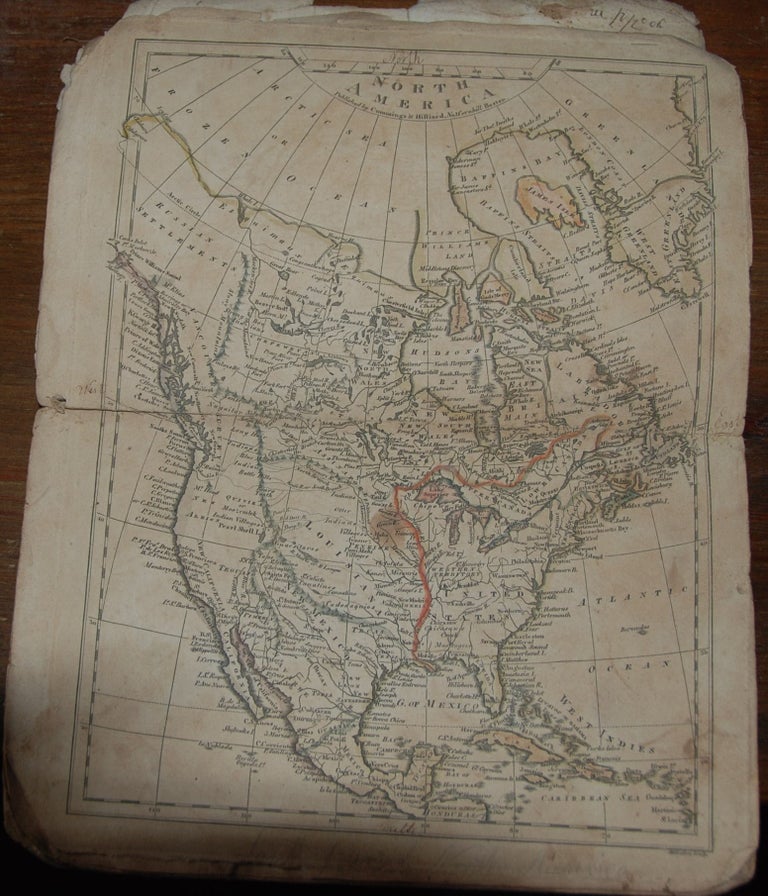
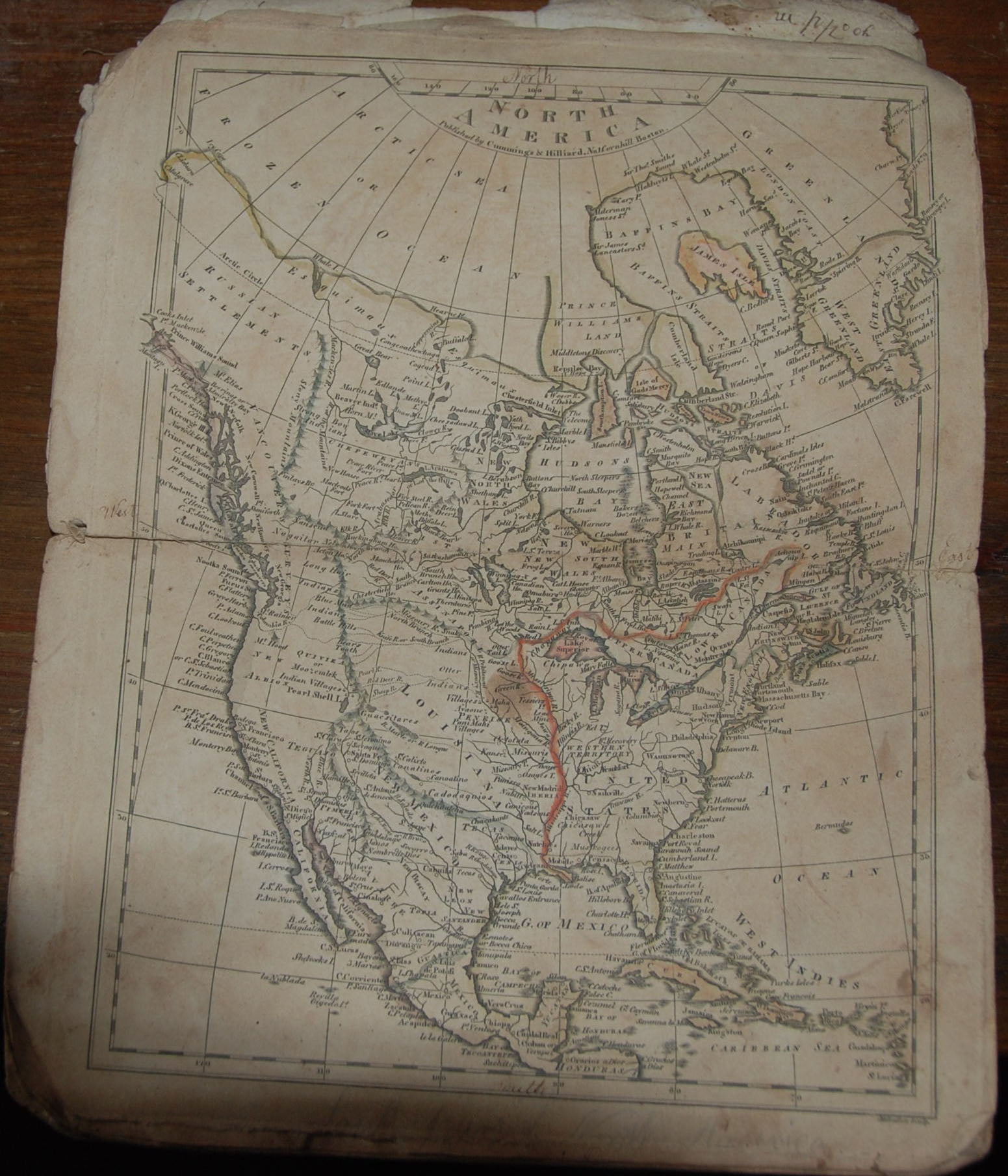
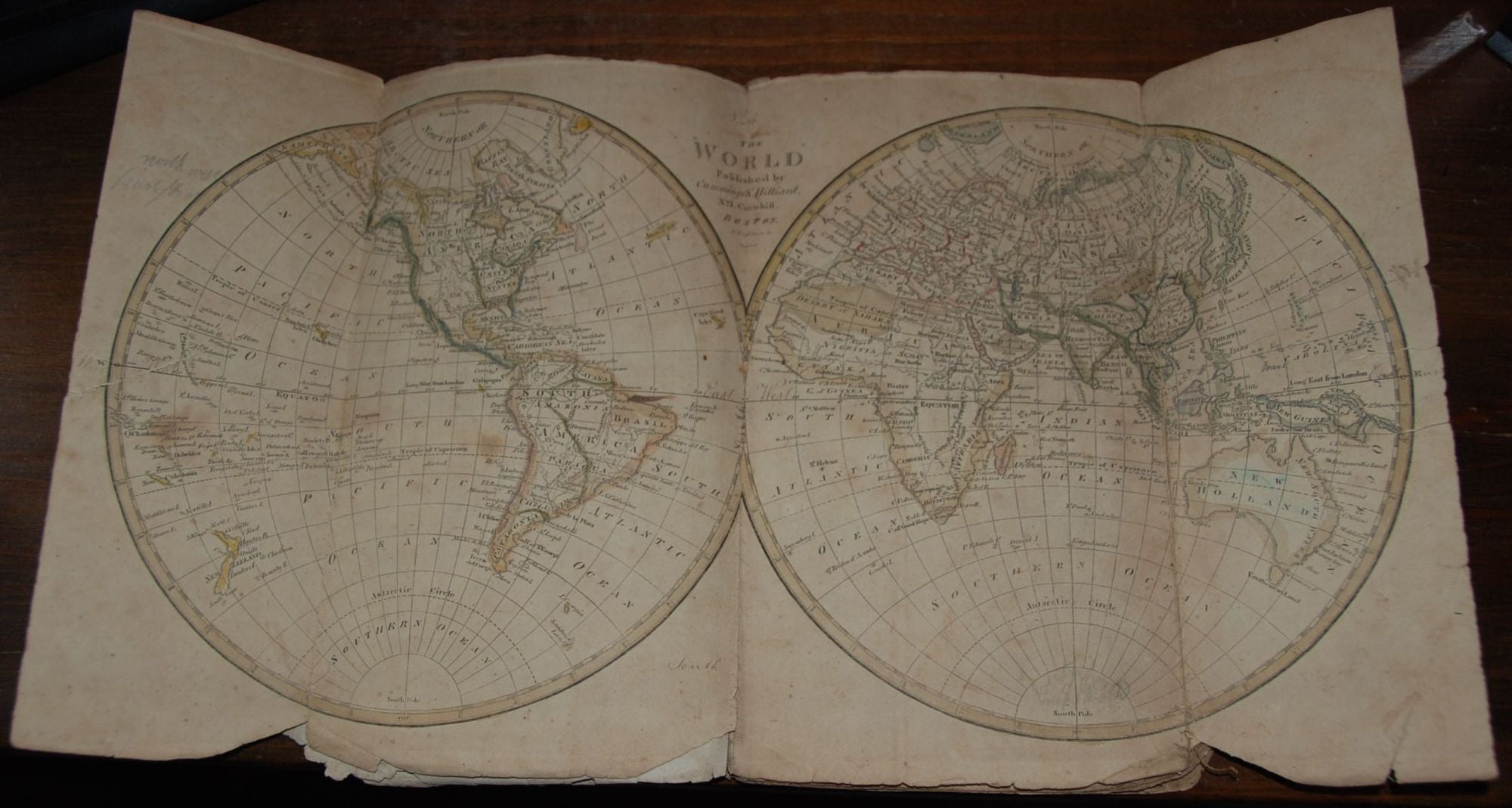
Boston: Cummings & Hillard, [1815]. Large 8vo, early marble paper wrappers, 8 maps, double page, some outline type coloring. Title page likely to be on original wrappers only, which is lacking in this copy, and wrappers are worn, some staining, and aging, early owner's signature(1815) with holograph list of the maps. Contains all eight folding maps. Phillips 275. Laid in is a "Plan of the first ward of the city of New York" engraved on wood by Butler & Morse (1835). Item #58104
The map of the United States shows Iowa and Minnesota as the Norwest Territory. In addition to the map of the U.S., the atlas includes maps of the world, Asia, North America, Africa, Britain, Europe and South America.
Price: $600.00 save 20% $480.00